At SkeyDrone, we are committed to helping our users gain better control, clarity, and confidence in the airspace they manage. Our latest release brings a powerful set of enhancements to Drone Radar and Drone Analytics, designed to streamline monitoring and give users more flexibility in how they interact with the platform.
Here’s a closer look at the new features now available:
1. Advanced monitoring preferences for control zones and flight plans
Customisation is key when managing complex operations, and our new individual monitoring preferences give Drone Radar users exactly that. You can now tailor your monitoring and alert settings per zone or flight plan—without affecting your organisation’s default configuration.
Whether you want to receive alerts for intrusions, conformance issues, or other specific events, you’re in full control. This means you’ll never miss what matters most to you, while your team members can stay focused on their own priorities.
You can configure default preferences that will be automatically applied to any newly created zone or flight plan. This eliminates the need for repetitive manual configuration, saving time and ensuring consistency across all zones.
Control zones will still be created and managed at the organisational level to maintain consistency.
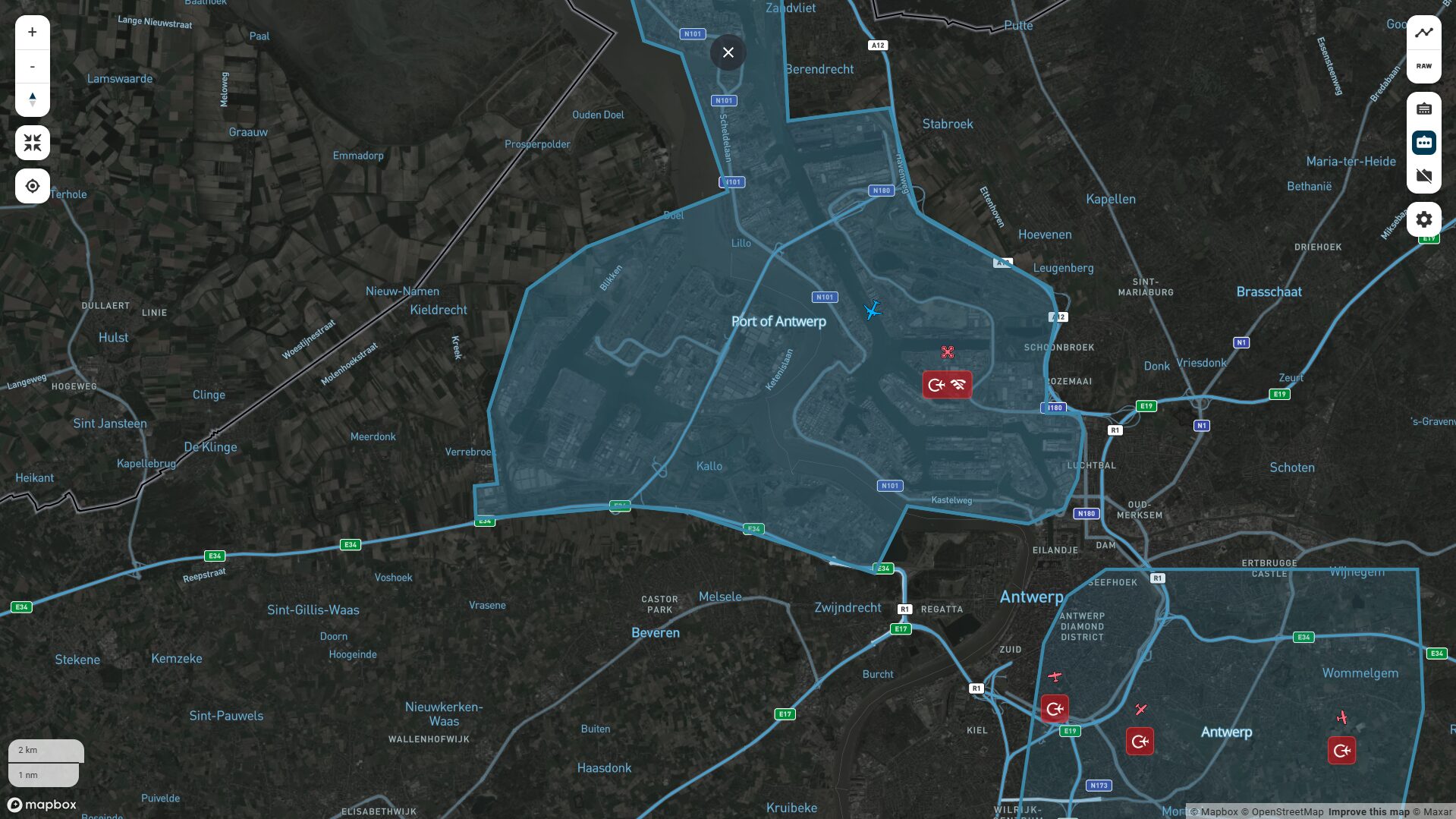
2. Visualise control zones in Drone Analytics
You asked, we delivered. Drone Analytics now offers a clear visual display of control zones and Areas of Responsibility (AoRs) directly on the map.
With just a click in the map settings, you can show or hide these zones based on your operational needs. This new feature provides the visual clarity needed to stay in control.
3. Map zoom level preserved when filtering
Drone Analytics users can now adjust filters without losing their current zoom level. This small but powerful improvement ensures the map stays focused on the area that matters most—making it easier to maintain context as you refine your view.
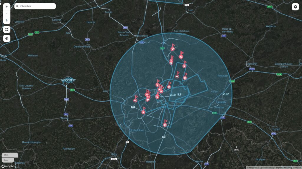
4. New Twilight map view as default
Introducing the Twilight Street-Satellite Map (see figure 1), now the default map style in both Drone Radar and Drone Analytics. This hybrid view combines detailed street maps with high-resolution satellite imagery to help you quickly identify key landmarks. The darker tones increase contrast and improve drone visibility—especially in busy or complex airspaces.
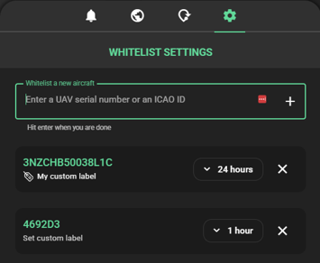
5. Custom labels for whitelisted drones
Our earlier update to the whitelisting feature brought new efficiencies, and we’re now expanding on that with custom labels. Easily tag whitelisted drones with names, use cases, or operator identifiers. This makes sorting and identifying friendly traffic simpler and faster during real-time operations.
6. New preference settings for a more personalised experience
You can now tailor your platform experience with individual settings for measurement units (metres or feet), time display (UTC or CEST), and interface theme (dark or light mode). These preferences are saved at the user level and automatically applied in future sessions—ensuring a consistent experience every time you log in.
These enhancements mark another step forward in our mission to empower users with the tools they need to ensure safe, efficient, and informed drone operations. Whether you’re securing a control zone, assessing drone traffic patterns, or coordinating complex airspace usage, these features are designed to support your operational goals.
Stay tuned—there’s more innovation on the horizon!
Log in to your Drone Radar and Drone Analytics applications today to see these new features in action.